Precision Agriculture Solutions

At DroneScape, we leverage advanced drone technology to revolutionize agricultural management. Our precision agriculture services provide farmers with detailed insights that were previously impossible to obtain through traditional methods.

Modern farming requires data-driven decision making to maximize yields while minimizing resource usage. Our specialized agricultural drone surveys give you a comprehensive view of your fields, helping you identify issues before they impact your crops and bottom line.

From detailed crop health monitoring to comprehensive irrigation analysis, our services help you maintain optimal growing conditions while reducing costs and improving resource allocation for sustainable farming practices.

Agricultural Drone Survey
Crop Health Monitoring

Crop Health Monitoring

Our multispectral imaging technology allows us to assess the health of your crops with incredible precision. By capturing data beyond what's visible to the human eye, we can help you:

  • Identify stressed plants before visual symptoms appear
  • Detect nutrient deficiencies with NDVI (Normalized Difference Vegetation Index) analysis
  • Monitor crop development throughout the growing season
  • Create prescription maps for variable rate applications

This proactive approach to crop management helps you address issues before they become visible problems, saving time and resources while maximizing yield potential.

Learn More

Irrigation Analysis

Our advanced thermal imaging technology allows us to assess water distribution and identify irrigation issues with unprecedented accuracy. Our irrigation analysis helps you:

  • Detect water stress before crops show visible symptoms
  • Identify irrigation system inefficiencies and leaks
  • Map drainage patterns across your fields
  • Optimize water usage with targeted irrigation recommendations

By optimizing your irrigation strategy, you can reduce water usage by up to 30% while improving crop health and yield, leading to significant cost savings and environmental benefits.

Learn More
Irrigation Analysis
Yield Estimation

Yield Estimation

Our yield estimation service provides accurate pre-harvest predictions to help you plan effectively. Using advanced algorithms and multispectral data, we can:

  • Generate field-level yield predictions with high accuracy
  • Create yield zone maps showing variations across your fields
  • Track growth rates and development stages
  • Provide historical comparisons to previous seasons

These insights enable better harvest planning, improved market timing, and more accurate financial forecasting for your agricultural operation.

Learn More

Pest & Disease Detection

Our specialized imaging technology can identify pest infestations and disease outbreaks before they cause significant damage. Our detection services help you:

  • Identify early signs of pest activity or disease spread
  • Map weed distributions for targeted control measures
  • Monitor the effectiveness of pest management strategies
  • Reduce pesticide use through precise application

Early detection allows for targeted interventions, reducing chemical usage by up to 40% while maintaining effective pest and disease control across your fields.

Learn More
Pest & Disease Detection

Our Process

1

Initial Consultation

We begin with a detailed discussion of your farm's specific needs, challenges, and goals to tailor our services accordingly.

2

Drone Flight & Data Collection

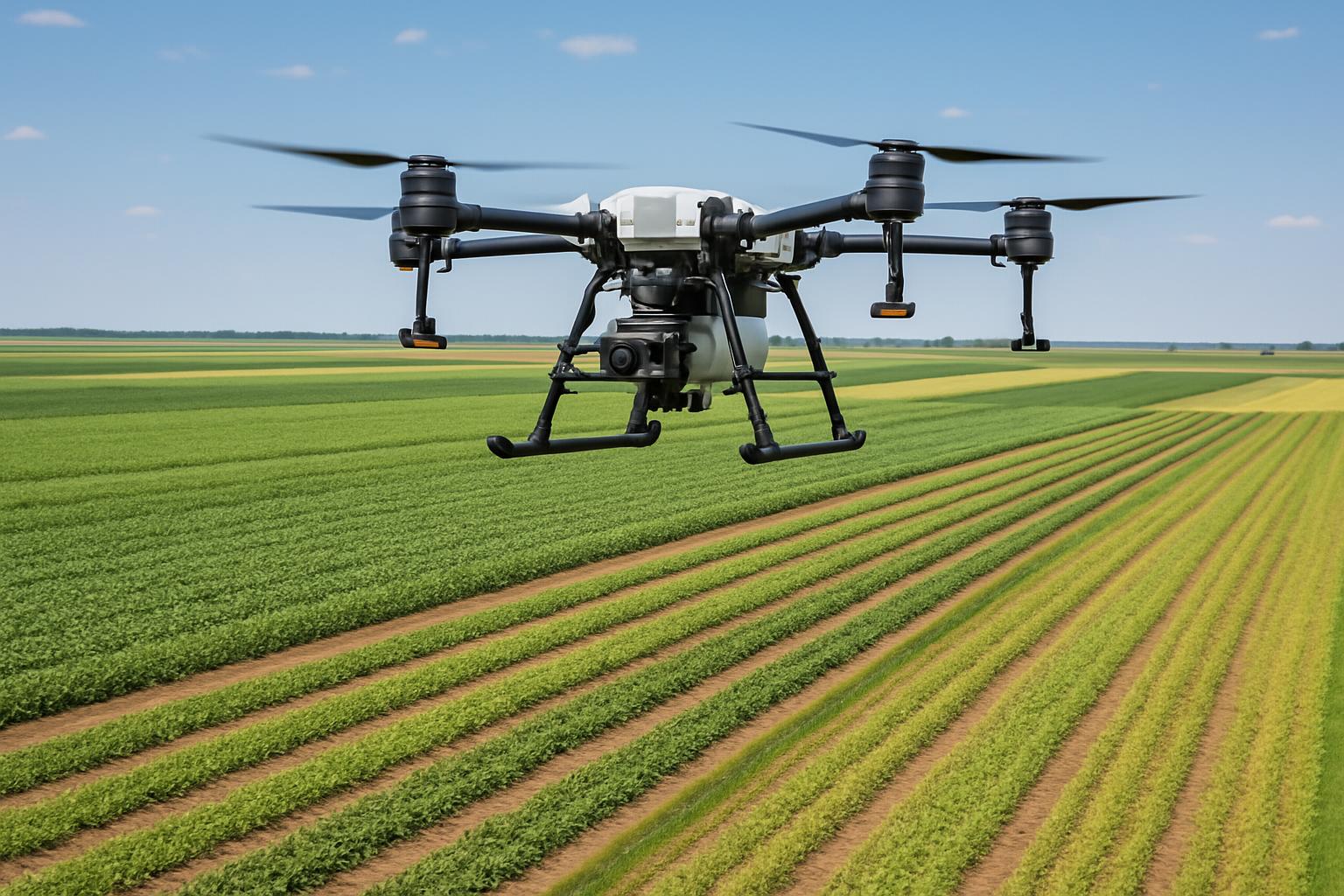
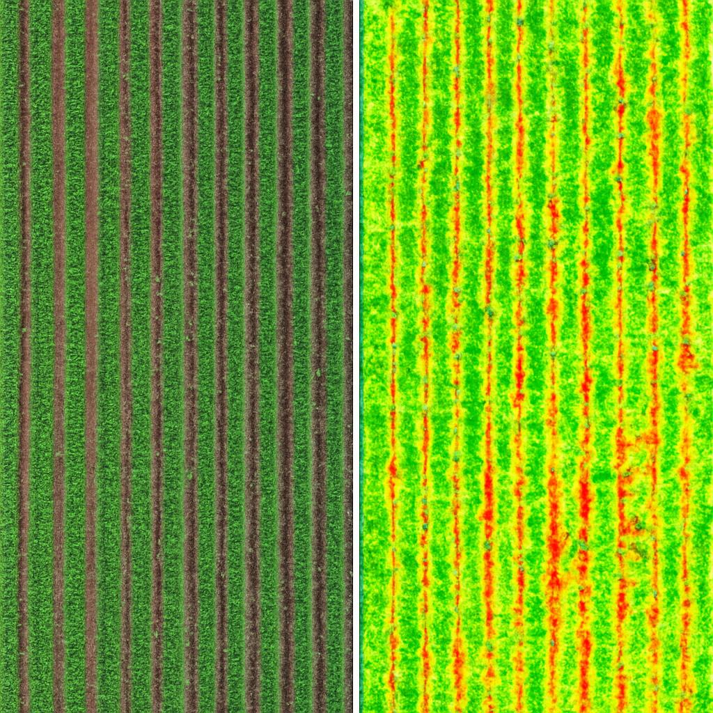
Our expert team conducts comprehensive drone flights over your fields, capturing multispectral imagery and detailed terrain data.

3

Data Processing & Analysis

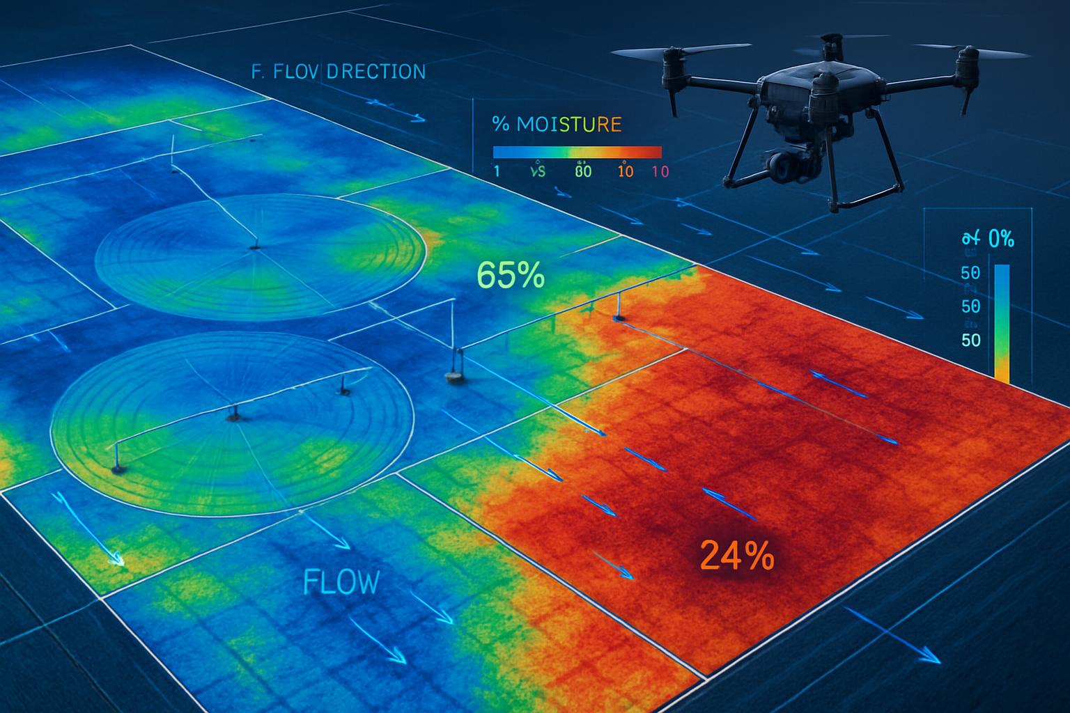
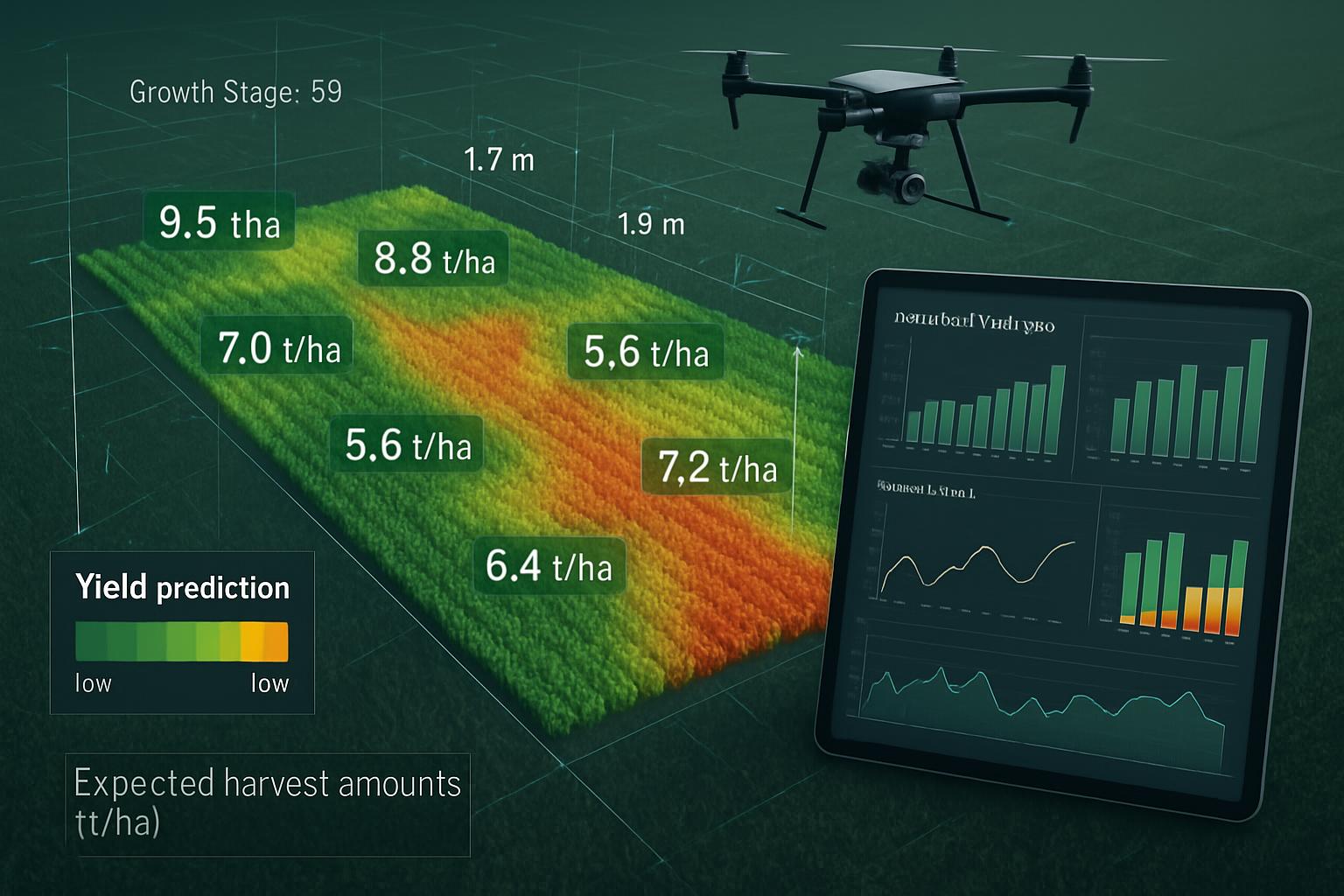
We process the collected data using advanced software to create detailed maps, identify issues, and generate actionable insights.

4

Insights & Recommendations

Our team provides you with specific recommendations based on the analyzed data, prioritized by potential impact on yield and profitability.

5

Implementation Support

We offer ongoing support to help you implement our recommendations and integrate the insights into your farm management system.

Success Story

Case Study - Stellenbosch Farms

Stellenbosch Farms Transformation

Stellenbosch Farms was facing challenges with inconsistent crop yields and high water usage. After implementing our comprehensive drone services:

  • They increased overall yield by 25% through targeted interventions
  • Reduced water usage by 30% through optimized irrigation
  • Decreased pest damage by 40% with early detection and targeted treatment
  • Lowered fertilizer costs by 20% through precision application

"DroneScape's services have completely transformed our approach to farm management. The detailed insights have helped us make data-driven decisions that have significantly improved our yields while reducing our environmental impact." - Johan van der Merwe, Farm Manager

Our Packages

Basic Assessment

Contact for Pricing
  • Single Drone Flight
  • Basic Orthomosaic Images
  • Simple Field Overview
  • Basic Crop Health Assessment
  • Digital Report
  • Irrigation Analysis
  • Historical Data Comparison
  • Online Access Portal

Premium Monitoring

Contact for Pricing
  • Seasonal Drone Flights (4-6 per year)
  • All Comprehensive Package Features
  • Pest & Disease Monitoring
  • Seasonal Growth Comparisons
  • Variable Rate Application Maps
  • Integration with Farm Management Software
  • Priority Support
  • Annual Strategy Consultation

Frequently Asked Questions

How often should we conduct drone surveys of our farm?

The optimal frequency depends on your crops and specific needs. For most farms, we recommend surveys at key growth stages (4-6 times per growing season). However, farms with high-value crops or specific challenges may benefit from more frequent assessments, while others might only need seasonal surveys.

How large of an area can you survey in a day?

Our drone systems can typically survey 200-300 hectares per day under optimal conditions. For larger farms, we schedule multiple days to ensure comprehensive coverage. The exact area depends on the level of detail required, weather conditions, and the specific services requested.

How accurate are your crop health assessments?

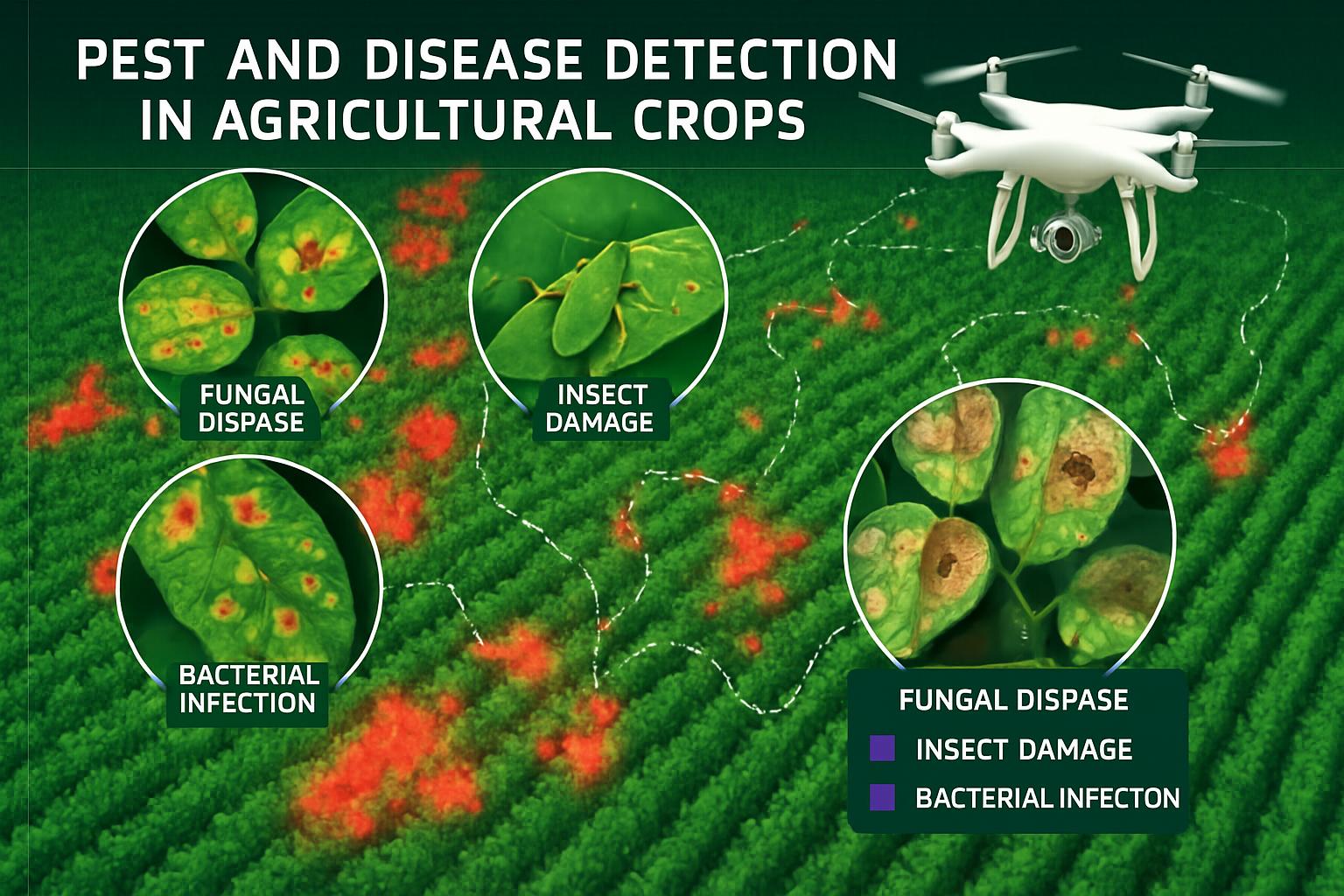
Our multispectral sensors can detect plant stress up to two weeks before it becomes visible to the human eye, with accuracy rates exceeding 90%. We validate our findings with ground-truthing to ensure reliability, and our systems are calibrated to account for different crop types and growth stages.

Can your drones fly in all weather conditions?

Our drones operate best in clear conditions with winds below 25 km/h. We cannot fly in rain, fog, or high winds for safety and data quality reasons. However, we monitor weather forecasts closely and schedule flights during optimal conditions to ensure high-quality data collection.

How do we access the data and reports after the survey?

All data, maps, and reports are accessible through our secure online portal. You'll receive login credentials to access your farm's information from any device. The portal includes interactive features that allow you to explore maps, compare historical data, and download reports as needed. We can also integrate with popular farm management software systems.

Ready to Transform Your Agricultural Management?

Contact us today to schedule a consultation and discover how our drone services can help you increase yields while reducing costs and environmental impact.

Get in Touch